[Flickr] 在 Google Earth 和 Google Maps 上瀏覽 Flickr 的相片


2007/11/06 09:55 1,287Views


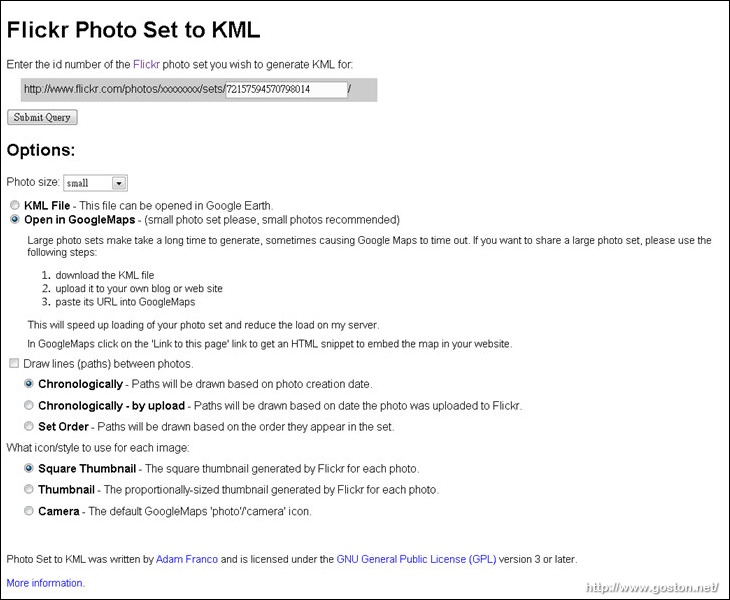
今天要介紹的是「Flickr Photo Set to KML」這個實用的服務, 它能讓你在「Google Earth」或「Google Maps」上瀏覽「Flickr」Sets 中有做地圖定位的相片。

「Flickr Photo Set to KML」的使用方式相當簡單, 只要將想瀏覽的 Set 編號輸入, 然後決定要顯示的相片大小, 並選擇要輸出成「Google Earth」用的「KML」檔, 或是直接在「Google Maps」開啟, 然後按下「Submit Query」鍵即可:

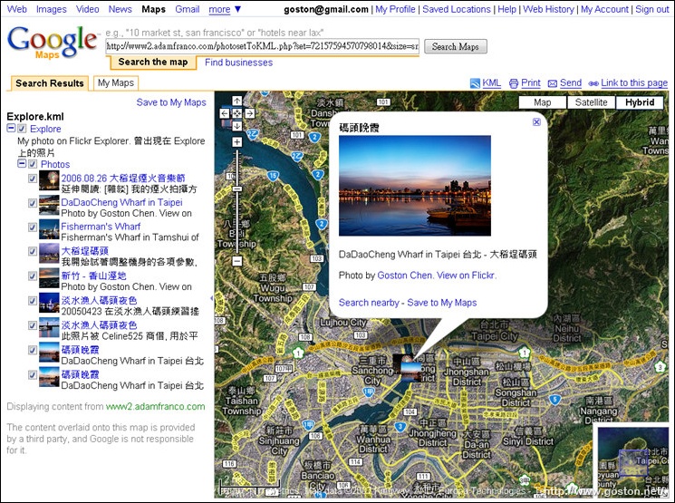
下圖是直接用「Google Maps」開啟的範例:

有興趣的人快找個 Set 來試試吧!

相關連結:

Technorati Tags: , ,

Entry Filed under: Flickr

post to del.icio.us  post to MyShare  post to HEMiDEMi  post to funP

1 Comment Add your own

  • 1. Ramius  |  2007/11/06 15:28

    如果要選直接在「Google Maps」開啟的話,那麼set真的要很小才可以。我試了40張照片的set開不起來,10張的set就可以在Google Maps上看到照片。如果set比較大的話,建議存KML來玩比較好。

    Using Opera Opera 9.50 on Windows Windows XP

Leave a Comment

Required

Required, hidden

Some HTML allowed:
<a href="" title=""> <abbr title=""> <acronym title=""> <b> <blockquote cite=""> <cite> <code> <del datetime=""> <em> <i> <q cite=""> <strike> <strong>

Trackback this post  |  Subscribe to the comments via RSS Feed


Donate Me

Related Posts

Recent Posts

Recent Comments